A Guide to Public Waterfront
Access Points Across Ontario
The water is public, but getting to it legally requires knowing where to look
Ontario has more than 250,000 kilometres of shoreline along its lakes, rivers, and streams. Millions of people want to swim, fish, paddle, or simply sit by the water. And yet finding a place where you can legally access the waterfront without owning lakefront property or paying a park entry fee can be surprisingly difficult, especially in southern Ontario where development has consumed much of the shoreline.
Public waterfront access in Ontario comes in many forms: municipal parks and beaches, provincial parks, conservation areas, boat launches, road allowances that reach the water, and Crown land access points. Some are well marked with signs and parking lots. Others are unmarked paths that locals know about but visitors would never find. Understanding the types of public access available and how to find them is the first step toward enjoying the waterfront that belongs to all of us.
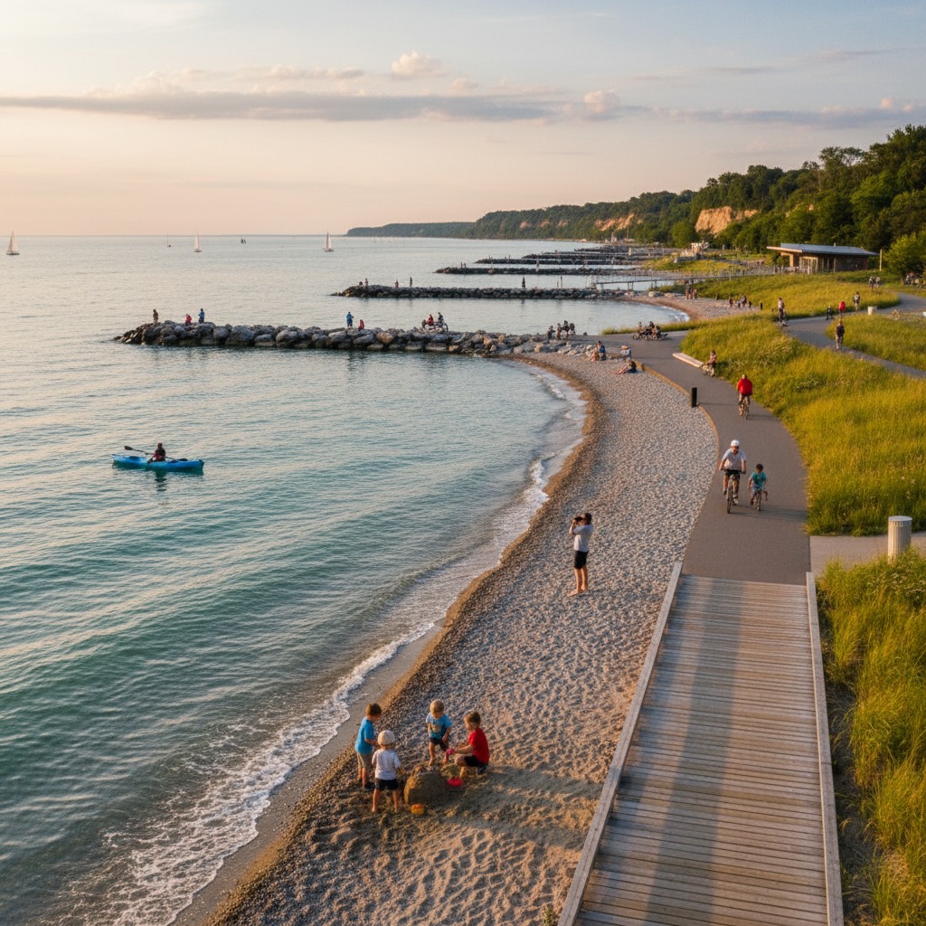
Municipal Parks and Beaches
Municipal parks along waterways and lakeshores are the most straightforward form of public access. Most Ontario municipalities maintain at least a few waterfront parks, and larger towns and cities may have extensive waterfront trail systems, beaches, and boat launches. These are generally free to use, though some may charge for parking during peak season. The quality and maintenance of municipal waterfront parks varies widely, from beautifully maintained urban waterfront promenades to undeveloped road ends with rudimentary access.
Finding municipal waterfront parks is as simple as checking the municipality's website or contacting the parks department. Many municipalities have maps showing the locations of all their parks, including waterfront access points. Google Maps and similar services also show public parks, though they may not distinguish between waterfront and inland facilities.
Road Allowances
One of the least-known sources of public waterfront access in Ontario is the road allowance. When much of the province was surveyed in the 19th century, roads were laid out on a grid pattern, with allowances extending from the interior to the water's edge. Many of these road allowances were never developed as roads, and in many cases they have been incorporated into adjacent private properties through use, fencing, or landscaping. But unless the municipality has formally closed the road allowance, it remains public property and the public has the right to use it to access the water.
Identifying open road allowances requires research. Municipal offices maintain records of road closures, and original survey plans showing the road grid are available through the Ontario government's Crown land records. Some municipalities and lake associations have inventoried their road allowances and produced maps showing which ones provide waterfront access. The process of identifying and accessing road allowances can be challenging, but the effort often pays off with access to quiet, uncrowded stretches of shoreline.
Conservation Areas
Ontario's 36 conservation authorities own and manage hundreds of conservation areas across the province, many of which provide waterfront access. Conservation areas typically charge an entry fee, which helps fund maintenance and operations. The facilities range from developed parks with beaches, trails, and picnic areas to more natural reserves with limited infrastructure. Many conservation areas are located on rivers and offer excellent access for fishing, paddling, and swimming.
Provincial Parks
Ontario Parks manages over 300 provincial parks, many of which are on lakes or rivers and provide waterfront access. Day-use permits are required and can be purchased online or at the park gate. Provincial parks generally offer the best-maintained facilities, including supervised beaches, boat launches, and waterfront campgrounds. The trade-off is cost, as day-use fees and camping rates have been rising, and availability, as popular parks fill up quickly during peak season.
Crown Land
In northern and central Ontario, Crown land provides vast areas of free public access to waterways. Approximately 87 percent of Ontario is Crown land, and much of it is accessible for recreation including fishing, hunting, paddling, and camping. In southern Ontario, Crown land is more limited, but some parcels along rivers and lakes provide valuable public access points.
Identifying Crown land access points requires consulting the Ontario Crown Land Atlas, an online mapping tool that shows the boundaries of Crown land across the province. Access to Crown land is generally unrestricted, though some parcels may be subject to land use permits, resource management agreements, or other designations that affect public use. Camping on Crown land for up to 21 days at a single site is permitted without charge in most areas, making it an affordable way to enjoy extended waterfront access.
Boat Launches
Public boat launches are a practical access point for paddlers and anglers, even if you do not have a motorized boat. Municipal, conservation authority, and provincial park boat launches can be used to launch canoes, kayaks, and paddleboards. Some are free, while others charge a launch fee. The quality varies from paved ramps with parking to informal gravel pull-offs with barely enough room for one vehicle.
Finding boat launches can be done through municipal websites, conservation authority maps, and online paddling resources. Several Ontario paddling organizations maintain databases of launch points organized by waterway. Local fishing shops and outfitters are also good sources of information about access points in their area.
Protecting What We Have
Public waterfront access in Ontario is under pressure. Road allowances are closed. Parkland budgets are cut. Development consumes shoreline. The access points that remain are more heavily used than ever. Protecting and expanding public waterfront access requires advocacy at the municipal level, financial investment in maintenance and new acquisitions, and a public that shows up to use and care for the access it has. The water belongs to everyone. But the paths to reach it need to be fought for.
By Dale Burrows, Recreation and Outdoors Writer