The Quiet Disappearance of
Coastal Wetlands in Ontario
Decades of drainage, development, and neglect have stripped away the shoreline ecosystems that protect water quality and support biodiversity
Drive along the Lake Erie shore from Port Dover to Point Pelee, and you pass through some of the most productive agricultural land in Canada. What you do not see is what used to be there. Before European settlement, this region was rimmed with coastal marshes, swamps, and wet meadows that filtered water, buffered storm surges, and supported an extraordinary diversity of fish, birds, and amphibians. Most of that wetland cover is gone.
Southern Ontario has lost an estimated 70 percent of its original wetland area, and along the Great Lakes coast, the losses are even more pronounced. The remaining coastal wetlands are scattered, often degraded, and under continued pressure from development, invasive species, and fluctuating water levels. Despite decades of policy aimed at protecting them, the disappearance continues, quietly and incrementally, in ways that rarely make headlines.
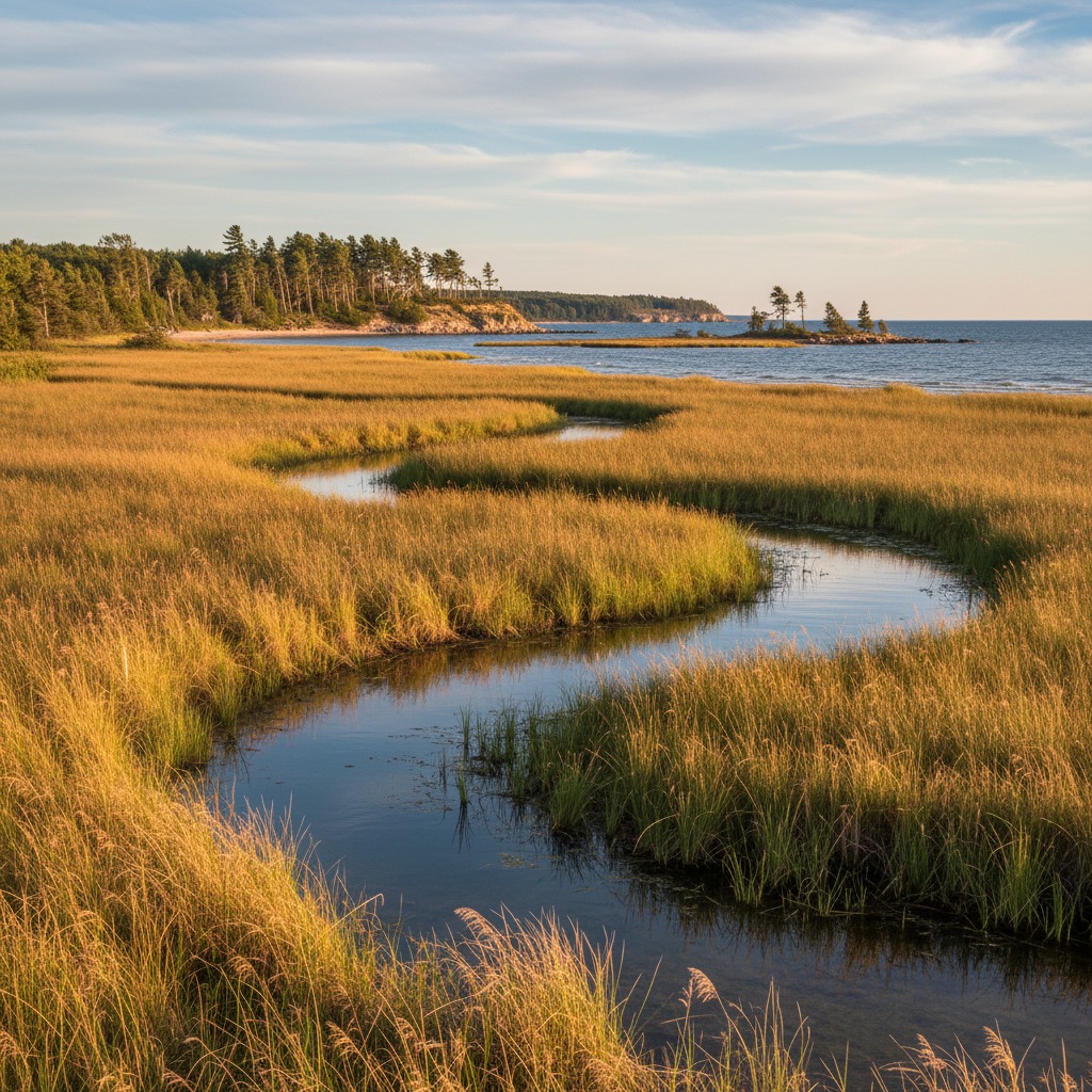
What Coastal Wetlands Do
Coastal wetlands are among the most ecologically productive landscapes in Ontario. They function as natural water treatment systems, trapping sediment and absorbing nutrients and pollutants before they reach open water. A healthy coastal marsh can remove significant quantities of nitrogen and phosphorus from runoff, directly reducing the nutrient loading that drives algae blooms in the Great Lakes.
These wetlands also serve as critical habitat. More than 40 species at risk in Ontario depend on coastal wetlands for at least part of their life cycle. They are nursery areas for commercially and recreationally important fish species including pike, bass, and yellow perch. Migratory birds use coastal wetlands as stopover and breeding habitat along the major flyways that cross the Great Lakes. Amphibians, turtles, and aquatic insects all depend on the shallow, vegetated waters that coastal wetlands provide.
From a purely economic perspective, coastal wetlands provide flood protection by absorbing and slowly releasing water during storm events and spring runoff. They buffer shorelines from wave action, reducing erosion on adjacent properties. Studies have estimated that the ecosystem services provided by Great Lakes coastal wetlands, including water filtration, flood protection, carbon storage, and recreational value, are worth billions of dollars annually across the basin.
How the Losses Happened
The draining of Ontario's coastal wetlands began in the 19th century and accelerated through the mid-20th century. Agriculture was the primary driver. Coastal marshes were drained, diked, and converted to farmland, particularly along the Lake Erie and Lake St. Clair shorelines where the flat, fertile soils beneath the wetlands were prized for cash crops. Municipal drainage schemes, subsidized by provincial programs, channelized streams and lowered water tables across large areas, eliminating wetlands that had persisted for millennia.
Urban and residential development consumed additional wetland area, particularly around the western end of Lake Ontario and along the shores of Lake Simcoe. Waterfront subdivisions were built on filled wetlands. Marinas and harbours replaced natural shoreline. Roads and infrastructure fragmented the remaining wetland complexes, cutting them off from the water level fluctuations they depend on to function.
The construction of the St. Lawrence Seaway and its associated water level regulation structures in the 1950s altered the natural hydrology of Lake Ontario and the upper St. Lawrence River, with lasting consequences for coastal wetlands. Natural water level fluctuations are essential for wetland health. They create the cycles of flooding and exposure that prevent any single plant species from dominating and maintain the diverse mosaic of open water, emergent vegetation, and wet meadow that characterizes a healthy coastal marsh. Regulated water levels dampened these fluctuations, contributing to the degradation of wetlands that remained.
The Current State
Today, the coastal wetlands that survive are in varying condition. Some, particularly those within protected areas such as Point Pelee National Park, Long Point National Wildlife Area, and various conservation authority properties, are relatively intact and actively managed. Others, especially those on private land or along developed shorelines, are degraded by nutrient loading, invasive species, and continued encroachment.
Phragmites australis, the European strain of common reed, has become the dominant threat to many remaining coastal wetlands. This aggressive invasive species forms dense monocultures that crowd out native plants, reduce habitat diversity, and alter the hydrology of the wetlands it colonizes. Control efforts are underway at numerous sites, but the scale of the invasion outpaces the resources available for management.
Water level variability continues to stress coastal wetlands. The extreme high water on Lake Ontario in 2017 and 2019 flooded many wetlands beyond the conditions that their plant communities could tolerate. Conversely, extended periods of low water expose lakebed and allow invasive plants and woody vegetation to establish in areas that should be open water or emergent marsh.
Protection and Restoration
Ontario's planning framework includes several policies intended to protect remaining wetlands. The Provincial Policy Statement designates significant wetlands and restricts development within them. Conservation authorities regulate development in and around wetlands under the Conservation Authorities Act. The federal Fisheries Act protects fish habitat, which includes many coastal wetlands.
Despite these protections, losses continue. Development pressure leads to boundary disputes about where wetlands actually begin and end. Landowners sometimes drain or fill wetlands before they can be designated. Small, isolated wetlands often fall below the thresholds that trigger protection. And enforcement of existing regulations is inconsistent, with conservation authorities struggling to monitor vast areas with limited staff and budgets.
Restoration efforts are underway at numerous sites across Ontario. The Great Lakes Sustainability Fund and its successor programs have supported wetland restoration projects at dozens of locations. Conservation authorities and non-profit organizations have acquired wetland properties for protection and management. Some of the most ambitious restoration projects have focused on re-establishing hydrological connections between diked or drained areas and the lake, allowing natural water level fluctuations to return.
These efforts are producing results, but they operate at a fraction of the scale needed to offset ongoing losses. For every hectare of wetland restored, others continue to degrade. The gap between the rate of loss and the pace of restoration remains significant.
What Needs to Change
Reversing the decline of coastal wetlands in Ontario requires action on multiple fronts. Stronger enforcement of existing protections would help stem ongoing losses. Updated wetland mapping using modern remote sensing technology would identify and protect wetlands that are currently undocumented. Incentive programs for private landowners who maintain or restore wetlands on their property could expand the conservation footprint beyond public lands.
Perhaps most importantly, the conversation about coastal wetlands needs to shift from viewing them as obstacles to development toward recognizing them as infrastructure. In an era of increasing flood risk, deteriorating water quality, and biodiversity decline, the services that coastal wetlands provide are becoming more valuable, not less. Protecting what remains and restoring what has been lost is not just an environmental priority. It is an economic and community resilience imperative.
The coastal wetlands of Ontario took thousands of years to develop. They have been diminished in a matter of generations. Whether they survive in any meaningful form will depend on the decisions made in the next few decades.
By Maren Falk, Environment Editor